
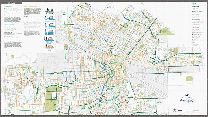
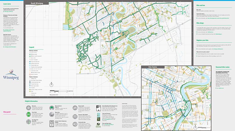
With over 400 kilometres of bicycle lanes, neighbourhood greenways, and multi-use paths, there are plenty of options for your next cycling trip. We’ve recently updated our cycling map to make planning your routes and navigating Winnipeg even easier.
“The new map is available in French and English so cyclists will be able to take advantage of this helpful resource,” said Chris Baker, our Senior Active Transportation Coordinator.”
“The map outlines both formal cycling routes, as well as informal routes, based on suggestions and input from local cyclists themselves.
With our biking infrastructure growing year after year, Baker said the cycling map is growing along with it as new routes and connections are completed, many of them in conjunction with on-going roadway construction projects.
You can view a PDF version of the cycling map online. A printed version will also be available in library branches.
“The routes identified on the map were developed as a result of the Council approved Pedestrian Cycling Strategy, and in consultation with key cycling groups, to ensure they meet the needs of persons of all ages and abilities,” said Baker.